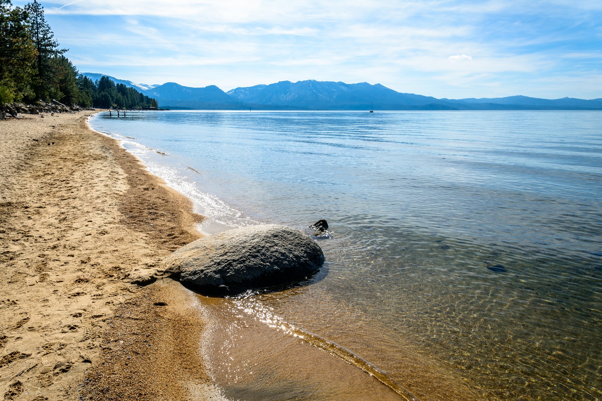
The South Lake Tahoe shoreline

Outdoors

Biking and mountain biking near South Lake Tahoe

Trails and recreation areas near South Lake Tahoe open to biking and mountain biking.

24places to ride
1 mito the closest
14within 30 miles
March–Novemberbest months

Good to know: Wilderness areas are closed to bikes; check each area’s trail rules and yield to hikers and horses.

Closest picks

1

Lake Tahoe Basin Management Unit

1 mi south · USDA Forest Service

Follow the slideshow links for information on camping reservations, beaches and picnic areas, Desolation Wilderness permits, Taylor Creek Visitor Center, Tallac Historic Site, summer recreation and much more!
2

Badgers Den at Camp Richardson Resort

3 mi west · USDA Forest Service

Badger’s Den Campground provides a Lake Tahoe and Camp Richardson Resort experience unlike any other.

3

Eagles Nest at Camp Richardson Resort

3 mi west · USDA Forest Service

Eagles Nest Campground provides a Lake Tahoe and Camp Richardson Resort experience unlike any other.

Map of all 24 places

Map of 24 places loads as you scroll.

Within 30 miles (14)

1 mi south · USDA Forest Service

Lake Tahoe Basin Management Unit

Follow the slideshow links for information on camping reservations, beaches and picnic areas, Desolation Wilderness permits, Taylor Creek Visitor Center, Tallac Historic Site, summer recreation and much more!

  • Biking
  • Boating
  • Camping
  • Fire Lookouts/Cabins Overnight
  • Fishing
  • Hiking
  • Horse Camping
  • Horseback riding

3 mi west · USDA Forest Service · Campground

Badgers Den at Camp Richardson Resort

Badger’s Den Campground provides a Lake Tahoe and Camp Richardson Resort experience unlike any other.

  • Biking
  • Boating
  • Camping
  • Fishing
  • Hiking
  • History
  • Horseback riding
  • Hotel/Lodge/Resort Fs Owned

3 mi west · USDA Forest Service · Campground

Eagles Nest at Camp Richardson Resort

Eagles Nest Campground provides a Lake Tahoe and Camp Richardson Resort experience unlike any other.

  • Biking
  • Boating
  • Camping
  • Fishing
  • Hiking
  • History
  • Horseback riding
  • Hotel/Lodge/Resort Fs Owned

3 mi northeast · USDA Forest Service · Campground

Nevada Beach Campground

Nevada Beach Campground sits in the Lake Tahoe Basin of Nevada. Minutes from the bright blue water of Tahoe's eastern shores, campsites are nestled in a sparse forest of pine trees and evergreen shrubs.

  • Biking
  • Boating
  • Camping
  • Fishing
  • Ranger programs
  • Water sports

3 mi west · USDA Forest Service · Campground

RV Village Campground at Camp Richardson Resort

The RV Village provides a Lake Tahoe and Camp Richardson Resort experience unlike any other.

  • Biking
  • Boating
  • Camping
  • Fishing
  • Hiking
  • History
  • Horseback riding
  • Hotel/Lodge/Resort Fs Owned

4 mi west · USDA Forest Service · Campground

Fallen Leaf Campground

Fallen Leaf Campground is situated on the north shore of Fallen Leaf Lake and adjacent to Taylor Creek. The south shore of Lake Tahoe is less than a mile away.

  • Biking
  • Boating
  • Camping
  • Fishing
  • Hiking
  • History
  • Ranger programs
  • Swimming

4 mi southeast · USDA Forest Service · Campground

Hope Valley

Hope Valley Campground is located in its beautiful namesake valley at an elevation of 7,300 feet, just 40 minutes south of Lake Tahoe. Visitors enjoy fishing the West Fork Carson River and exploring local trails.

  • Biking
  • Camping
  • Fishing
  • Hiking
  • Wildlife viewing

5 mi north · USDA Forest Service · Campground

Zephyr Cove RV & Campground

Lake Tahoe is one of the most stunning destinations on the planet, making it a top choice for outdoor enthusiasts who enjoy RV cruising and camping.

  • Birding
  • Boating
  • Camping
  • Golf
  • Hiking
  • Horseback riding
  • Jet Skiing
  • Kayaking

10 mi northwest · USDA Forest Service · Campground

Meeks Bay Resort

NO PETS ARE ALLOWED ANYWHERE AT THE RESORT! Meeks Bay Resort has a long tradition as a family vacation and holiday retreat.

  • Backpacking
  • Biking
  • Birding
  • Camping
  • Canoeing
  • Cultural Activities
  • Fishing
  • Hiking

12 mi south · USDA Forest Service · Campground

Kit Carson Campground

Nestled in a forest of Jeffrey pines and aspens, Kit Carson campground is perfect for tent camping and smaller RVs. The west fork of the Carson River is located next to the campground, with several sites right next to the water.

  • Biking
  • Camping
  • Fishing
  • Hiking

15 mi northwest · USDA Forest Service · Campground

Kaspian Campground

Kaspian Campground is located in a mature forest of pine trees overlooking the beautiful Lake Tahoe. Campers will be nestled in a sparse forest of pine trees and evergreen shrubs, just minutes from the bright blue water of Tahoe.

  • Biking
  • Boating
  • Camping
  • Fishing
  • Hiking
  • Ranger programs
  • Swimming
  • Water sports

15 mi southwest · USDA Forest Service · Campground

Wrights Lake Equestrian Campground

The Wrights Lake Equestrian Campground is available to visitors travelling with equestrian or packstock animals.

  • Biking
  • Boating
  • Camping
  • Fishing
  • Wildlife viewing

17 mi southeast · Bureau of Land Management

Indian Creek Recreation Area

Situated in the eastern foothills of the Sierra Nevada, Indian Creek Recreation Area offers a variety of outdoor recreation opportunities highlighted by Indian Creek Reservoir, Indian Creek Campground and the East Fork of the Carson River.

  • Biking
  • Boating
  • Camping
  • Fishing
  • Hiking
  • Hunting
  • Picnicking
  • Ranger programs

27 mi northeast · Bureau of Land Management

Jumbo Grade Trailhead

The Jumbo Grade Trailhead is a day-use staging area for visitors setting out on the Jumbo Grade Trail. The wide, rugged 8-mile trail takes riders from the Washoe Lake area to the historic town of Virginia City, Nevada.

  • Hiking
  • History
  • Horseback riding
  • Mountain Biking
  • Off-highway vehicles

30 to 75 miles (10)

32 mi north · Bureau of Reclamation

Boca Reservoir

Boca Dam and Reservoir are features of the Truckee Storage Project . The reservoir is on the Little Truckee River, 27 miles southwest of Reno, Nevada. Open year-round (frozen during winter).

  • Biking
  • Boating
  • Camping
  • Fishing
  • Hiking
  • Horseback riding
  • Picnicking
  • Recreational Vehicles

36 mi southwest · Bureau of Reclamation

Sly Park Reservoir

Recreation at Sly Park Reservoir is managed by the El Dorado Irrigation District under an agreement with the Bureau of Reclamation's Central CA Area Office. The reservoir was created by Sly Park Dam across Sly Park Creek.

  • Biking
  • Boating
  • Camping
  • Fishing
  • Hiking
  • Horseback riding
  • Picnicking
  • Water sports

39 mi southeast · Bureau of Land Management

Faye-Luther Trail System

This trail system contains approximately 9 miles of loop and connector trails, with two trailheads at Fay-Luther and Jobs Peak.

  • Biking
  • Hiking

43 mi north · USDA Forest Service

Humboldt-Toiyabe National Forest Headquarters

.

  • Biking
  • Camping
  • Climbing
  • Fishing
  • Hiking
  • Horse Camping
  • Horseback riding
  • Hunting

46 mi west · Bureau of Reclamation

Sugar Pine Reservoir

Recreation at Sugar Pine Reservoir is managed by Tahoe National Forest under an agreement with the Bureau of Reclamation. Sugar Pine Reservoir was created by Sugar Pine Dam across Shirttail Creek.

  • Biking
  • Boating
  • Camping
  • Fishing
  • Hiking
  • Horseback riding
  • Picnicking
  • Water sports

47 mi northwest · USDA Forest Service

Tahoe National Forest

  • Biking
  • Boating
  • Fishing
  • Hiking
  • Horse Camping
  • Horseback riding
  • Hunting
  • Off-highway vehicles

60 mi northwest · Bureau of Land Management

South Yuba Recreation Area

Remember your OUTDOOR ETHICS when enjoying your public lands. Please RECREATE RESPONSIBLY. Overview The South Yuba Recreation Area and National Trail is located approximately 10 miles northeast of Nevada City, California.

  • Accessible Swimming
  • Camping
  • Fishing
  • Hiking
  • History
  • Horseback riding
  • Mountain Biking
  • Photography

66 mi west · Bureau of Reclamation

Folsom Lake

Recreation at Folsom Reservoir is managed by the California Department of Parks and Recreation under agreement with the Bureau of Reclamation, Central California Area Office.

  • Biking
  • Boating
  • Camping
  • Fishing
  • Hiking
  • History
  • Horseback riding
  • Nature education

69 mi southwest · Bureau of Reclamation

New Melones Lake

New Melones Dam and Reservoir are part of the Central Valley Project - New Melones Unit operated by the Bureau of Reclamation. Located 60 miles upstream on the Stanislaus River from the confluence of the San Joaquin River.

  • Biking
  • Boating
  • Camping
  • Fishing
  • Hiking
  • Hunting
  • Picnicking
  • Ranger programs

70 mi west · Bureau of Reclamation

Folsom S. Canal Rec. Trail

The 69 mile long Folsom South Canal originates at Nimbus Dam on the American River in Sacramento County and extends southward, paralleling and to the east of State Highway 99 through San Joaquin County.

  • Biking
  • Hiking
  • Horseback riding

Distances are straight-line miles from downtown South Lake Tahoe. Listings come from Recreation.gov’s federal recreation database; check each official page for hours, fees, fire restrictions and closures before you go.

Get outside around South Lake Tahoe

Around South Lake Tahoe

Lakeside Beach, South Lake Tahoe
Lakeside Beach 2026-06-28 1Yelderberry ( talk ) · CC BY-SA 4.0
Relaxing South Lake Tahoe
Relaxing South Lake Tahoe (7617672710)Alex Proimos from Sydney, Australia · CC BY 2.0
Bijou Park, California, South Lake Tahoe
Bijou Park, CaliforniaLittleT889 · CC BY-SA 4.0

More outdoors near South Lake Tahoe

Questions

Where is the closest place for biking near South Lake Tahoe?

Lake Tahoe Basin Management Unit (USDA Forest Service), about 1 miles south of South Lake Tahoe as the crow flies. Next are Badgers Den at Camp Richardson Resort (3 mi) and Eagles Nest at Camp Richardson Resort (3 mi).

When is the best time for biking near South Lake Tahoe?

Based on South Lake Tahoe’s average highs, March–November. Conditions at higher elevations can be much cooler.

Who manages these places?

Federal agencies including USDA Forest Service, Bureau of Reclamation, Bureau of Land Management. Each listing links to its official page for hours, fees, closures and current conditions.

South Lake Tahoe AI

Your South Lake Tahoe local guide
Hey there!

I'm South Lake Tahoe AI. Ask about neighborhood food, independent shops, local history or planning a visit.

AI recommendations may be inaccurate. Verify hours and prices. Questions are processed by Cloudflare. Privacy